Hecterra
A solution for agriculture GPS tracking
This is a simple yet effective application for the agro-industry, which allows controlling field works based on telematics data. The agricultural GPS solution delivers transparent data about fields, crops rotation, and field operations to the employees and managers of agricultural enterprises. Having the exact information about who, when, and how was сultivating the crops, the clients can effectively plan and improve the agribusiness processes.
Special vehicles control
The clients get clear data about the quality and volume of the field operations, as well as about the actions of the agricultural vehicles and vehicle operators.
Reliable data
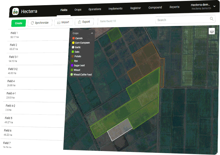
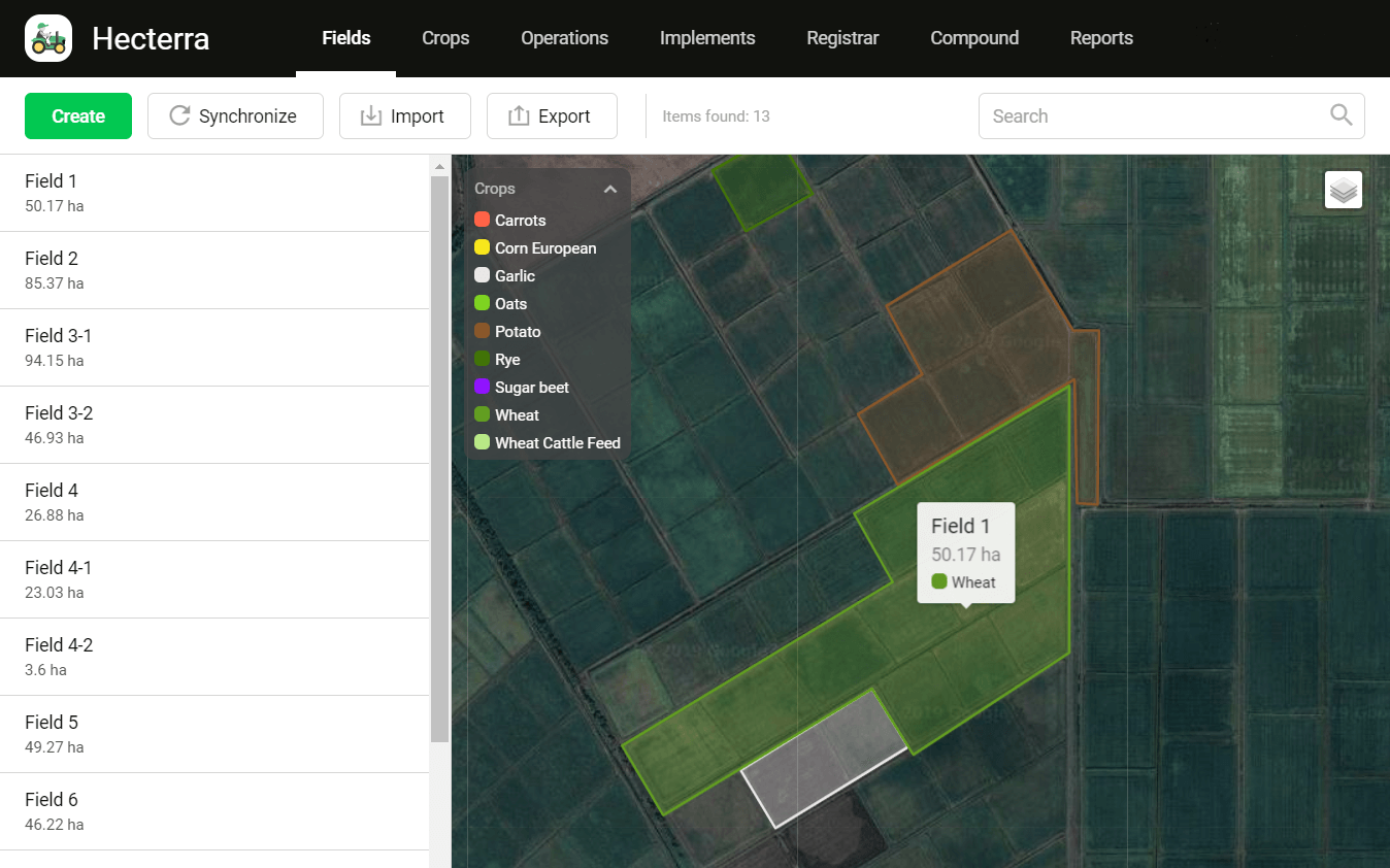
Hecterra calculates the field cultivations of complex shapes, taking in omissions, overlaps, and uncultivated areas inside the fields.
Automated calculations
The agro application calculates the cultivated field areas, fuel consumption, mileage, speed, and other parameters, saving employees’ time.
API integration
Transfer data from Hecterra and employ it in any accounting systems using API.
How GPS system works in agriculture
Import geofences as fields; set up trailers, drivers, and units in Wialon for further usage in Hecterra
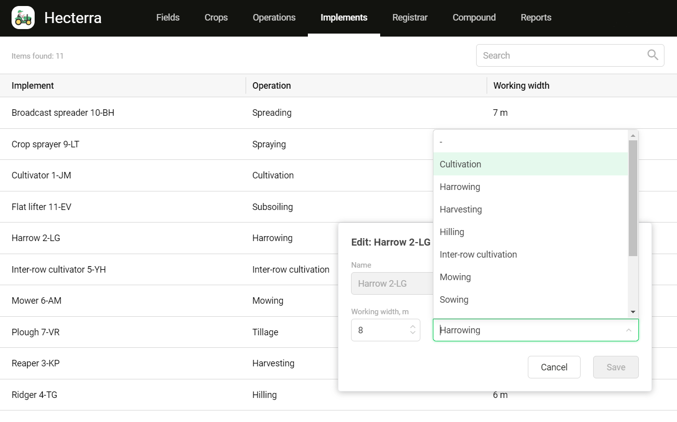
Fill in the crops, operations, and crops rotation catalogs
Approve or decline the detected field cultivations
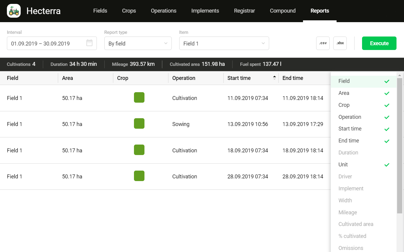
Generate and export comprehensive reports on field operations
Functionality of the agricultural GPS system
Import and creation of fields. Crop rotation control, crops catalog, and the detailed history of cultivations for each field.
Detection of new field cultivations. Options to edit and approve the cultivations before adding them to the registrar.
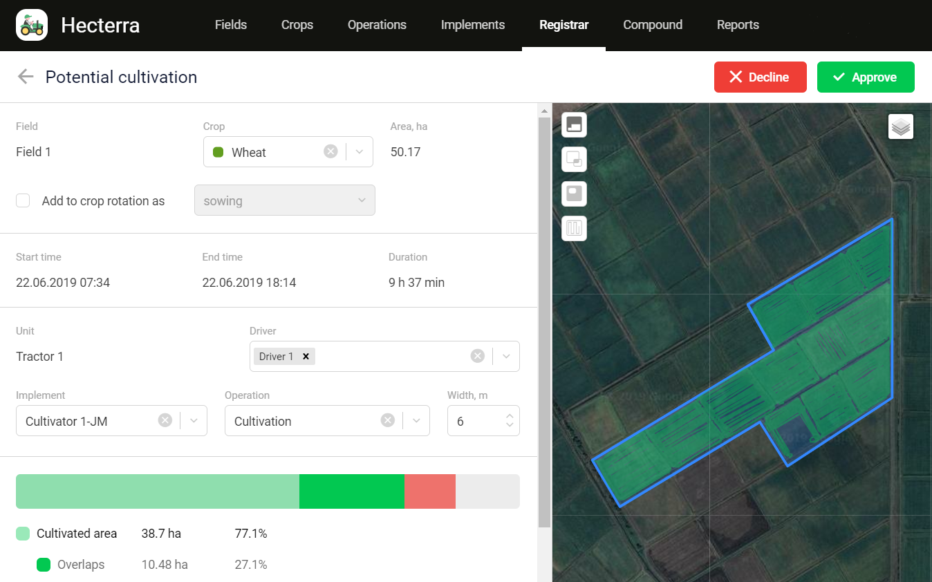
Using drivers, units, and trailers created in Wialon. Calculations of fuel consumption, speed, mileage for each field cultivation.
Easy reports generation by drivers, fields, operations, or units. CSV import option.
Hecterra webinar
Hecterra. Highlights of the agribusiness solution
Topics:
-
Hecterra applications and use cases
-
Key elements of the application and its configuration
-
Q&A session with the Product Manager
Recorded: April 30, 2020
Authors:
-
Oleg Zharkovsky, Wialon Trainers Team Lead, Gurtam
-
Katerina Alexandrova, Product Manager of Hecterra, Gurtam
Length: 55 minutes